
Fortæl dine venner om denne vare:
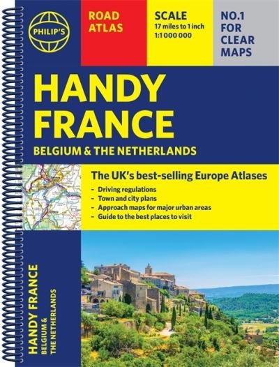
Philip's Handy Road Atlas France, Belgium and The Netherlands: Spiral A5 - Philip's Road Atlases
Philip's Maps
Pris
DKK 88
Bestilles fra fjernlager
Forventes klar til forsendelse 13. - 16. maj.
Tilføj til din iMusic ønskeseddel
Eller
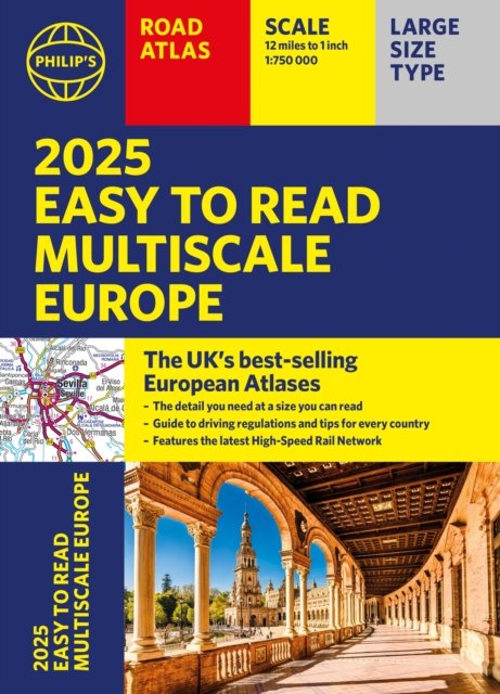
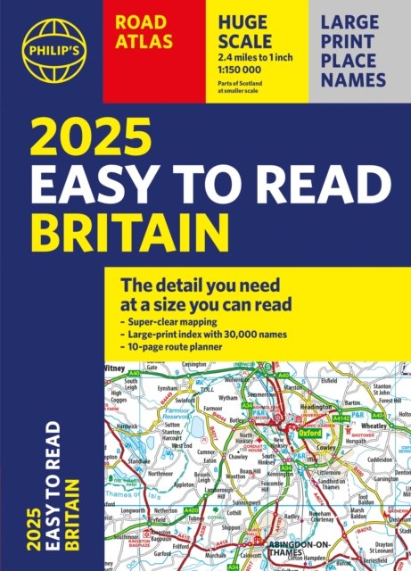
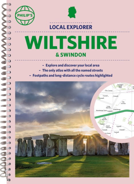
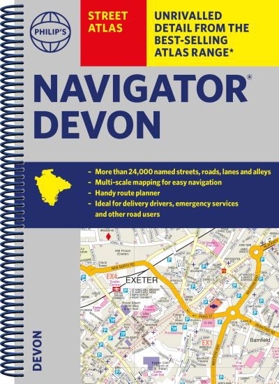
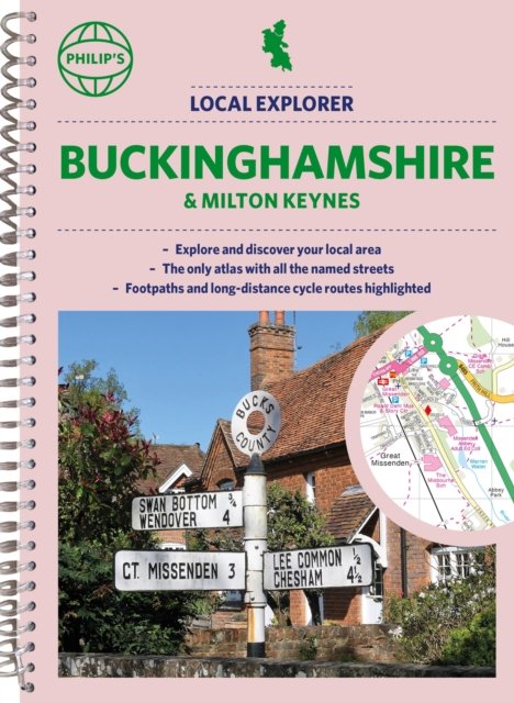
Philip's Handy Road Atlas France, Belgium and The Netherlands: Spiral A5 - Philip's Road Atlases
Philip's Maps
Philip's Handy Road Atlas of France, Belgium and The Netherlands features new digital cartography from Philip's - voted Britain's clearest and most detailed European mapping in an independent consumer survey. This compact A5 atlas with lie-flat binding is perfect for travelling across France and the surrounding countries.
64 pages
| Medie | Bøger Spiralbog (Bog med spiralryg) |
| Udgivet | 3. juni 2021 |
| ISBN13 | 9781849075565 |
| Forlag | Octopus Publishing Group |
| Antal sider | 64 |
| Mål | 211 × 156 × 12 mm · 116 g |
Vis alle
Mere med Philip's Maps
Andre har også købt
![Cover for George Orwell · Genudgivelser Paperback: 1984 (Paperback Bog) [11. udgave] (2019)](https://imusic.b-cdn.net/images/item/original/872/9788702291872.jpg?george-orwell-2019-genudgivelser-paperback-1984-paperback-bog&class=scaled&v=1575462060)
![Cover for Franz Kafka · The Essential Kafka: The Castle; The Trial; Metamorphosis and Other Stories - Wordsworth Classics (Paperback Bog) [UK edition] (2014)](https://imusic.b-cdn.net/images/item/original/260/9781840227260.jpg?franz-kafka-2014-the-essential-kafka-the-castle-the-trial-metamorphosis-and-other-stories-wordsworth-classics-paperback-bog&class=scaled&v=1413586223)
![Cover for Rune T. Kidde · Rune T. Kidde: Den store Rune T. Kidde-bog (Indbundet Bog) [1. udgave] (2017)](https://imusic.b-cdn.net/images/item/original/616/9788771657616.jpg?rune-t-kidde-2017-rune-t-kidde-den-store-rune-t-kidde-bog-indbundet-bog&class=scaled&v=1516615725)
![Cover for Hanne Overgaard Mogensen og Karen Fog Olwig (red.) · Familie og slægtskab (Hæftet bog) [1. udgave] (2013)](https://imusic.b-cdn.net/images/item/original/764/9788759316764.jpg?hanne-overgaard-mogensen-og-karen-fog-olwig-red-2013-familie-og-slaegtskab-haeftet-bog&class=scaled&v=1372716017)
![Cover for Dav Pilkey · Hundemand: Hundemand (8) - Plop 22 (Indbundet Bog) [1. udgave] (2021)](https://imusic.b-cdn.net/images/item/original/225/9788711983225.jpg?dav-pilkey-2021-hundemand-hundemand-8-plop-22-indbundet-bog&class=scaled&v=1608555208)
![Cover for Rick Riordan · Olympens helte: Olympens helte (2) - Neptuns søn (Indbundet Bog) [2. udgave] (2019)](https://imusic.b-cdn.net/images/item/original/219/9788711915219.jpg?rick-riordan-2019-olympens-helte-olympens-helte-2-neptuns-soen-indbundet-bog&class=scaled&v=1560096835)
![Cover for Rick Riordan · Olympens helte: Olympens helte (1) - Den fortabte helt (Indbundet Bog) [2. udgave] (2019)](https://imusic.b-cdn.net/images/item/original/172/9788711915172.jpg?rick-riordan-2019-olympens-helte-olympens-helte-1-den-fortabte-helt-indbundet-bog&class=scaled&v=1560096818)
![Cover for Atul Gawande · Being Mortal: Illness, Medicine and What Matters in the End (Paperback Bog) [Main edition] (2015)](https://imusic.b-cdn.net/images/item/original/828/9781846685828.jpg?atul-gawande-2015-being-mortal-illness-medicine-and-what-matters-in-the-end-paperback-bog&class=scaled&v=1447095435)


Se alt med Philip's Maps ( f.eks. Spiralbog , Paperback Bog , Hardcover bog og Kort )